By Germán Y. Ojeda, Editor-In-Chief
Recent marine geophysical projects in the Dominican Republic (DR) have brought me to this Caribbean paradise twice over the past 6 months. The DR offers all the attributes that a beach tourist can possibly expect in a tropical destination. Warm weather all year round, scenic mountainous and coastal landscapes, diverse and delightful cuisine, friendly and hospitable people, contagious dancing beats such as ‘bachata’ and ‘merengue dominicano’, and of course beautiful sandy beaches make the DR one of the top vacation hotspots in the Caribbean. The beach tourism industry represents a significant portion of DR’s economy. But for beach tourism to flourish -in the DR or anywhere- a sine qua non requirement needs to be met: A beach is needed. It’s not a matter of convenience, but a matter of survival for this industry. Let me explain why I felt compelled to write this editorial as an urgent call to action to save Arena Gorda beach from rapid disappearance.
Among the DR’s many fascinating touristic places is Punta Cana, located at the eastern end of the island of Hispaniola which encompasses Haiti and the DR. For the unenthusiastic flier that I am, an interesting destination that implies an under 3-hour plane ride is typically appealing (one more checkmark for Punta Cana in my case). Since the 70’s, international hotel chains have established large upscale resorts up and down Punta Cana’s shore, arguably at the expense of what used to be a pristine coastal ecosystem. I mention the word ‘ecosystem’ so that the reader pictures an untouched tract of land that most likely included estuaries, wetlands, mangroves, coastal lakes, dunes, coral reefs and of course sandy beaches, presumably in equilibrium with each other.
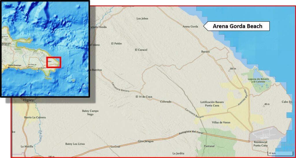
Figure 1. Location map of Arena Gorda Beach, eastern Dominican Republic (map made with National Geographic’s online map maker tool).
Take a look at a time-lapse series of aerial photography that reveals rapid development of Punta Cana over the last 4 decades published by Diario Libre here. Fast replacement of the native landscape by hotel sprawling in Punta Cana is evident. Rather than criticizing swift development I confess that I was glad someone spent big money to build great facilities that provide a pleasant experience to millions of vacationists from all over the world (including myself and family), year after year.
Unfortunately, these photographs are not as eloquent about the degradation of Arena Gorda Beach that I witnessed in person. Arena Gorda beach is 20 km up the coast from Cabo Engaño (Spanish for “Cape Deception”, a name attributed to Cristopher Columbus mistakenly thinking he had arrived to the Samaná Peninsula farther north), the easternmost point of the island. On map view, Arena Gorda appears as a linear stretch between Arena Gorda Point to the north, and Playa Bávaro to the south. The beachscape is classically Caribbean: Numerous palm trees, alluring beaches with white sands, straw roof gazeebos everywhere, and a never-ending parade of happy tourists.
What started as a regular criticism about the narrowness of our hotel’s beach by one of my travel companions turned into a short geological excursion to see what was going on. Take a look at what can be seen in the field. Erosion is eating up Arena Gorda beach as you read this. Various geoindicators lead me to raise my voice on this issue. Most palm trees have their roots (almost fully) exposed; an abrupt ~1-meter crenulated dune scarp; several toppled trees and tumbled beach signs; a meagre distance between the high water line and the dune scarp; and testimonials of people who were directly affected by Arena Gorda beach wearing away (as reported by Mejía, 2018, for example).
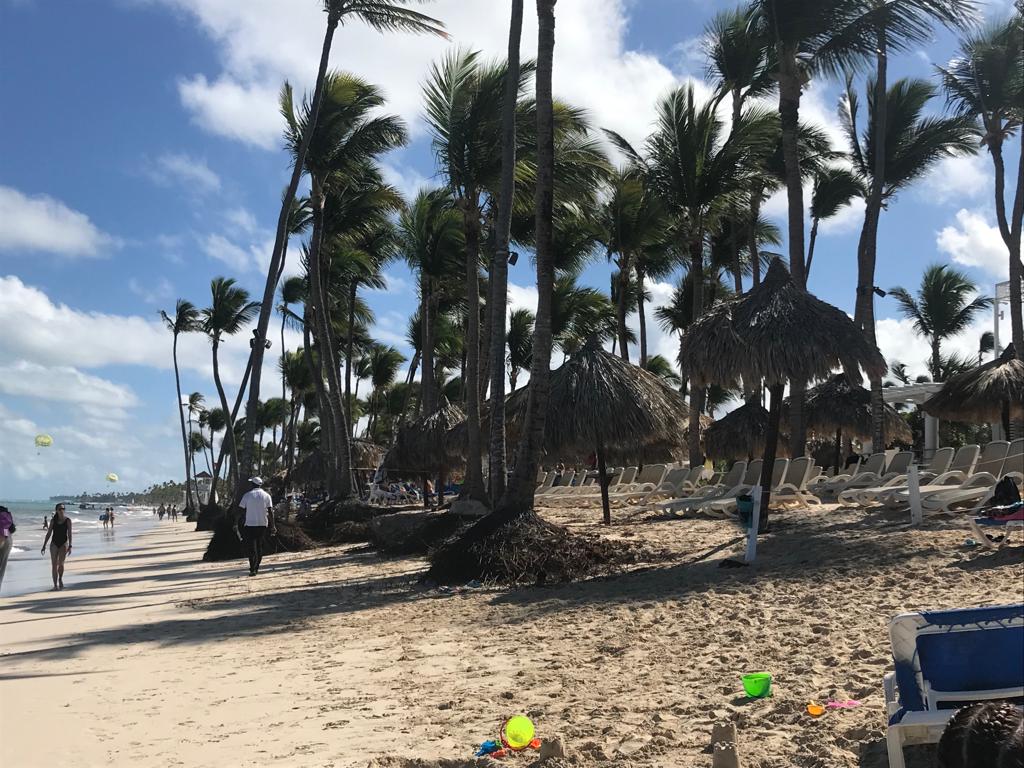
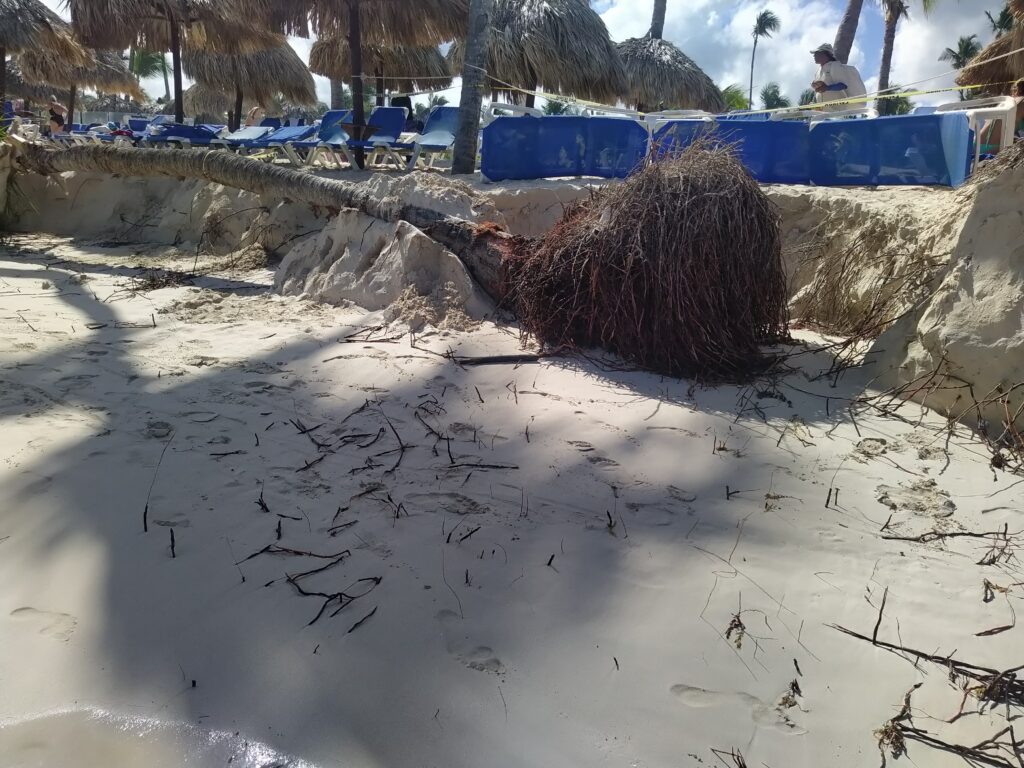
Figure 2. Left: A row of palm trees exhibiting root exposure. Right: Fallen palm tree next to a crenulated bluff (dune scarp), and beach chairs sitting on dune field. Note the short distance between the high water line and the dune at Arena Gorda beach.
To make matters worse, downed palm trees that were once standing on the dune field seem to have dragged large chunks of sand with them, augmenting erosion on the bluff face. Note that the entire Caribbean region is on the path of most extreme weather events sourced on the Atlantic Ocean. The DR has suffered its share of hurricanes and tropical storms over the last few years, further accentuating beach erosion. Tropical storm Isaias made landfall in Punta Cana in 2020, unleashing heavy rains and winds all over these beaches.
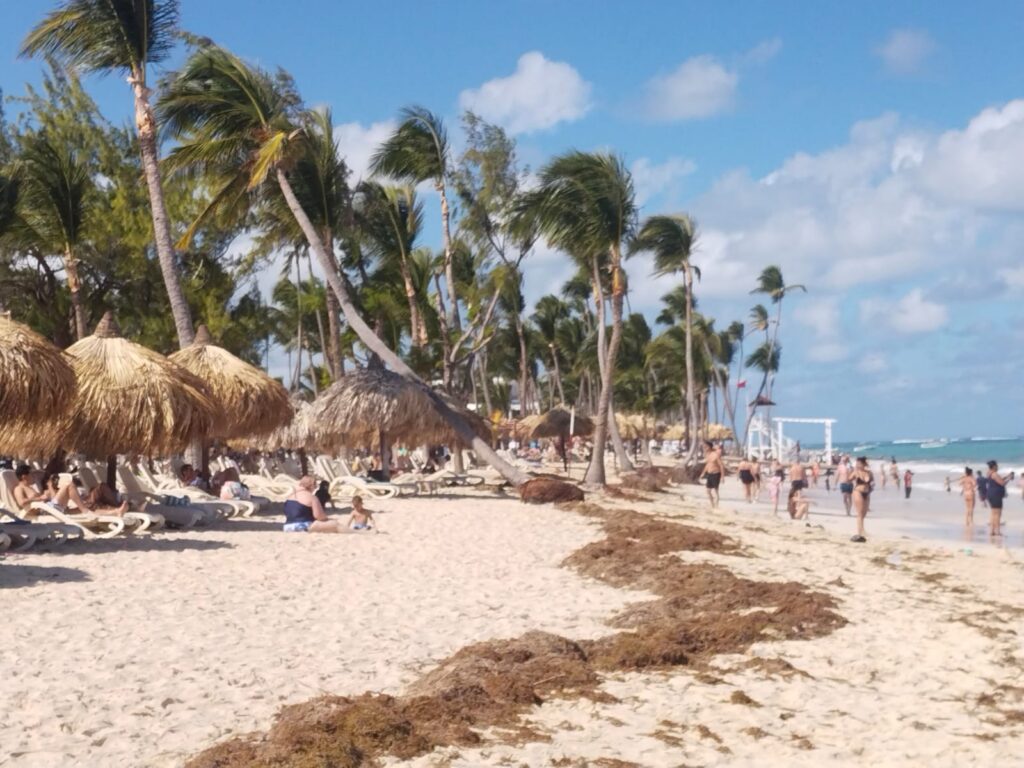
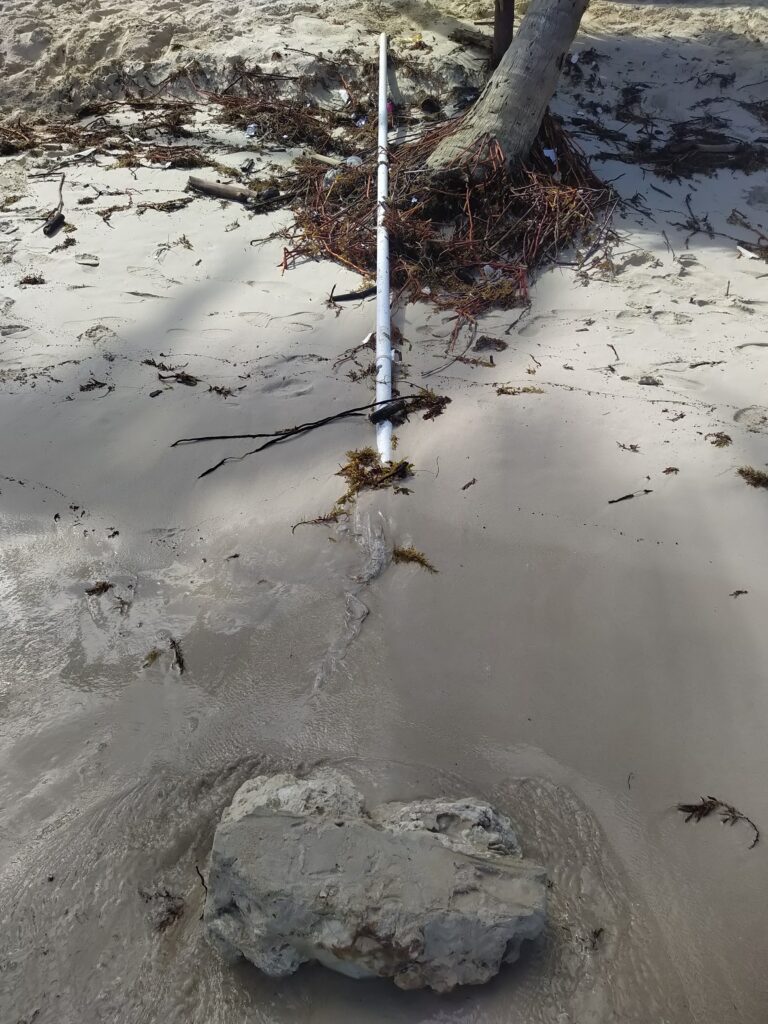
Figure 3. Left: Slanted palm tree leaning on beach gazeebo, about to tip over. Right: Tumbled sign pole and base. Arena Gorda beach, December 2022.
So, what’s the solution? Beach protection is no simple matter. No silver-bullet solution can be applied with guaranteed success. The reason is that healthy beaches are the result of a dynamic equilibrium among several oceanographic, geologic and climatic factors, most of which can’t be easily measured, modeled or accurately predicted. Winds, waves, tides, ocean-bottom currents, sand supply, underlying geological substrate, depth to bedrock, coastal habitats, etc. are all factors that interplay at various scales in time and space. But, there is an arsenal of tools out there to (1) understand the problem, (2) slow down erosion (3) protect and restore, and (4) manage the beach system (beach management ought to include a comprehensive monitoring program). The nearly-flat sandy area we frolic on is one element of the beach system, not the system itself. A responsible beach protection project needs to look at, and act on both the onshore and offshore directions away from the beach face. The reader is referred to USACE (1984) as a starting point. FastTIMES Vol 27 No 2 contains great examples on what near-surface Geophysics can do to better address coastal erosion problems. DR environmental authorities are urged to take action sooner rather than later. Ignoring the problem or postponing a protection project may result costlier than acting now.
References
Mejía, Mariela, 2018, Punta Cana: Paraíso Turístico Que Sucumbe A La Pérdida De Playa Y Al Afán Hotelero, Diario Libre online.
Coastal Engineering Research Center (US). (1984). Shore protection manual. Department of the Army, Waterways Experiment Station, Corps of Engineers, Coastal Engineering Research Center.


