
By Mark Treon, Christopher Miniello, Chris Enright, David Tedrow and Tyler Weldon.
Published: 07/09/ 2021
Introduction
The Colorado Department of Transportation (CDOT) collaborated with the Federal Highway Administration to conduct a series of research and development projects on tunnels. From 2017-2019, CDOT worked with Surveying and Mapping Inc. (SAM) to use LiDAR and thermal imaging cameras to identify abnormalities in concrete tunnel liners, as well as develop broader processes on utilizing LiDAR and thermal imaging for highway tunnel projects.
Background
On July 6, 2012, the Moving Ahead for Progress in the 21st Century Act (MAP-21) was passed by Congress and signed by the President. The Act recognized that the safety and security of the nation’s highway tunnels is exceedingly important. As an extension of the principles, the Federal Highway Administration (FHWA) developed the National Tunnel Inspection Standards (NTIS), the Tunnel Operations Maintenance Inspection and Evaluation (TOMIE) Manual, and the Specifications for National Tunnel Inventory (SNTI). In accordance with each, the data produced is maintained in the National Tunnel Inventory (NTI) database, and the conditions of tunnels around the country are tracked.[1]
The NTIS requires establishing a highway tunnel inspection program, maintaining a tunnel inventory, and reporting to FHWA of inspection results and, in particular, critical findings, which are any structural or safety-related deficiencies that require immediate follow-up inspection or action. The NTIS apply to all structures defined as highway tunnels on all public roads, on and off Federal-aid highways, including tribally and federally owned tunnels. Section 650.511 establishes a minimum inspection frequency of 24 months for routine tunnel inspections. An owner is permitted to increase the frequency of inspection based on a risk analysis approach that considers such factors as tunnel age, traffic characteristics, geotechnical conditions, and known deficiencies. An owner does not need FHWA approval to increase the frequency of inspection. An owner is permitted to decrease the frequency of inspection after a written request that considers tunnel age, time from last major rehabilitation, tunnel complexity, traffic characteristics, geotechnical conditions, functional systems, and known deficiencies has been reviewed and commented on by FHWA.[2]
The Strategic Highway Research Program (SHRP2) is a national partnership of the FHWA, the American Association of State Highway and Transportation Officials (AASHTO) and the Transportation Research Board (TRB). Under SHRP2, more than 100 research projects were undertaken in order to develop effective solutions to improve the way transportation professionals plan, operate, maintain and ensure safety on America’s roadways.[1]
The projects were focused on safety, renewal, reliability and capacity. SHRP2 R06G, which fell under the renewal category, focused on High-Speed Non-destructive Testing (NDT) Methods for Mapping Voids, Debonding, Delaminations, Moisture, and Other Defects Behind or Within Tunnel Linings. Tunnels are difficult to inspect for maintenance concerns or deficiencies such as leaks, concrete liner cracking, concrete spalling, delimitation and other debunking issues. Due to their confinement, heavy use, and typically long detours needed when they are closed to traffic, tunnels pose a unique operational challenge.[2]
By utilizing NDT methods, transportation agencies are able to inspect concrete bridge decks or tunnel linings beyond what the eye can see. The actual extent of deterioration can be defined, meaning improved repairs and real-time solutions. Ultimately, this results in a savings of both time and money.[3]
CDOT selected Survey and Mapping, LLC (SAM) as a consultant to assist in exploring technologies and developing procedures for engaging in Non-Destructive Testing (NDT) and Monitoring of the tunnels it manages and operates. The work was divided into two parts, Phase 1 and Phase 2.
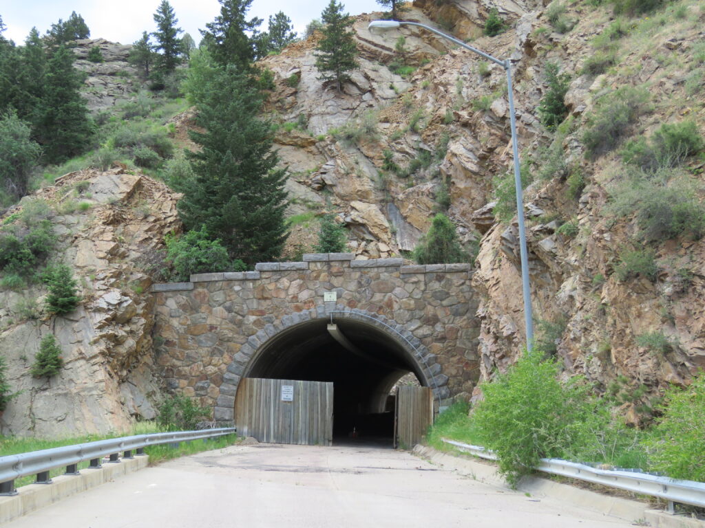
Phase 1, which focused on Clear Creek Tunnel 4 (a closed CDOT tunnel located in just west of Golden Colorado), identified the following objectives:
- Further explore the application of thermography and LIDAR as a NDT
- Create a truly mobile solution
- Create deliverables that are acceptable to the DOT and feed into their workflows
SAM engaged in extensive research into applicable technologies, along with a series of trial and error with cameras and equipment added to its existing mobile LIDAR system. Utilizing a FLIR A6750 series camera with a 13mm lens, data was collected from the tunnel on June 24, 2016. The following deliverables for CDOT were generated from the collection:
- LiDAR point cloud colored by thermal
- LiDAR point cloud with intensities
- Tunnel Triangulated Irregular Network (TIN) from 1 foot contour profiles
- Flattened thermal tunnel image
Although the process was successful, SAM believed there were opportunities for improvement for Phase 2 and identified the following as lessons learned:
- Temperatures and fluctuations should be defined with a scientific gauge to understand the best time to collect and ensure the sensor is capable of detection of thermal separation.
- The angle of the sun caused higher temperatures at the end of the tunnel where it was shining in, while the shaded part of the tunnel was much cooler. The sun warmed the tunnel lining as a whole in that area, lessening the temperature delta between areas where a thermal signature should have appeared. Based on this, SAM determined that collection should occur at night.
- The optimal time of day to collect data should be pre-determined for each tunnel, as a large enough temperature swing is necessary to facilitate temperature change in the tunnel lining. The separation of high and low temperatures at the portal of Tunnel 4 were greatly influenced by the position of the sun. For timing of future collections, it would be helpful to factor in not only the temperature, but the time of sunrise and sunset, as well.
- The use of multiple cameras would require less passes and less image stitching, ultimately reducing project time and increasing the quality of the final product.
- A Red, Green, Blue (RGB) camera should be integrated into data collection at the same time passes are made collecting thermal imagery to offer an additional perspective and confirm or refute potential areas of concern.
- Improve processes to enhance imagery of 2D tunnel surface
During Phase 2, which focused on Beavertail Tunnel, Hanging Lake Tunnel, and Clear Creek Tunnels 1, 2, 3, 5 and 6, SAM once more explored and experimented with various technologies with the intent of improving, supplementing, and verifying the data collected by the cameras.
Thermocouple data loggers proved to be an effective means of determining the best times during which to collect data in tunnels, and they were used in Beavertail and Hanging Lake Tunnels. RGB and HD thermal cameras were also added to the system and incorporated into the mobile LIDAR system with a custom-machined mount. To process and manage the large amount of data gathered during the collection, multiple high-end laptops with high speed solid state drives (SSDs) were utilized.
During August 2017, data from the seven tunnels was collected and generated into the following deliverables to CDOT:
- Point cloud with intensity
- Point cloud with thermal mapped colors
- Contours of tunnel created every 2 feet
- TIN mesh of tunnel
- FLIR self-viewing files
- Flattened image of thermal tunnel surface
- RAW FLIR video on .mp4
- Corresponding RGB images for each thermal image
Although the process was greatly improved from Phase 1, SAM identified the following lessons learned during Phase 2:
- A tunnel’s size impacts the number of passes required to capture its entire area
- RGB cameras should capture images in RAW format so they are better quality and can be better manipulated later
- A better exterior light solution with variable settings to adapt to each tunnel’s lighting/surfaces should be used
- Use of HD thermal cameras is important
- Owning thermal cameras is crucial for reliability and scheduling
- Thermocouple data loggers are necessary for large tunnels or tunnels located in areas where the environment is unfamiliar to the data collector
- The use of fans had little to no effect on results, as the piston effect created from moving traffic was stronger than the draft generated by fans
Following this experience, SAM recommends that the DOT should schedule data collection to coincide with any planned shutdowns for complex tunnels.
Impacts to traffic during SAM’s collections were minimal for simple tunnels, as the work was performed late night; although, where posted speed limits are lower, there would be little to no impact the traveling public.
The quality of the results was directly impacted by the level of technology in use. The cost of high-end equipment could be a significant burden if the user has not considered the costs of renting/purchasing/custom fabricating equipment, outfitting survey vehicles, and educating users on all aspects of operations and programs.
Finally, several benefits were identified during the processes, including the development of a workflow from beginning to end for acquiring tunnel data without completely shutting down traffic for an extended period of time. This benefits the DOT, the contractor and the traveling public. Furthermore, the methods advanced by SAM improve safety for those participating in tunnel inspections.
By vetting out the concept of NDT for tunnels maintained by CDOT, numerous technologies were identified, explored, ruled out, and improved. Additionally, SAM utilized equipment in ways that it may have never been intended, and by coupling certain technologies was able to identify best pairings of cameras, lenses, sensors, processing software, and other components. The data collected during Phases 1 and 2 is a positive front-end planning tool, as well as a strong quality control component for information determined by inspections conducted manually by professionals. The information serves as a stable reference for
DOTs who wish to utilize it for their own tunnel inspection process. Overall, the methods and information gathered by SAM contributed an asset management element to the inspection process.
The complete report is available from the CDOT Library at https://www.codot.gov/programs/research/pdfs/2018-Research-Reports/cdot-2018-18.pdf
Figures
References
[1] U.S. Department of Transportation, Federal Highway Administration, Tunnel Operations, Maintenance, Inspection, and Evaluation (TOMIE) Manual. Publication No. FHWA-HIF-15-005, July 2015.
[2] Office of the Federal Register, National Tunnel Inspection Standards (available from https://www.federalregister.gov/documents/2015/07/14/2015-16896/national-tunnel-inspection-standards), accessed 14 February 2018.
[3] Federal Highway Administration: “SHRP2Solutions” (available from https://www.fhwa.dot.gov/goshrp2/), accessed 10 January 2018.
[4] Ibid. (available from https://www.fhwa.dot.gov/goshrp2/Solutions/Renewal/R06G/Nondestructive_Testing_for_Tunnel_Linings), accessed 15 January 2018.
[5] AASHTO, “SHRP2Solutions” (available from http://shrp2.transportation.org/Pages/R06_NondestructiveTesting.aspx), accessed 15 January 2018.
